12 Awesome Day Hikes in Yellowstone
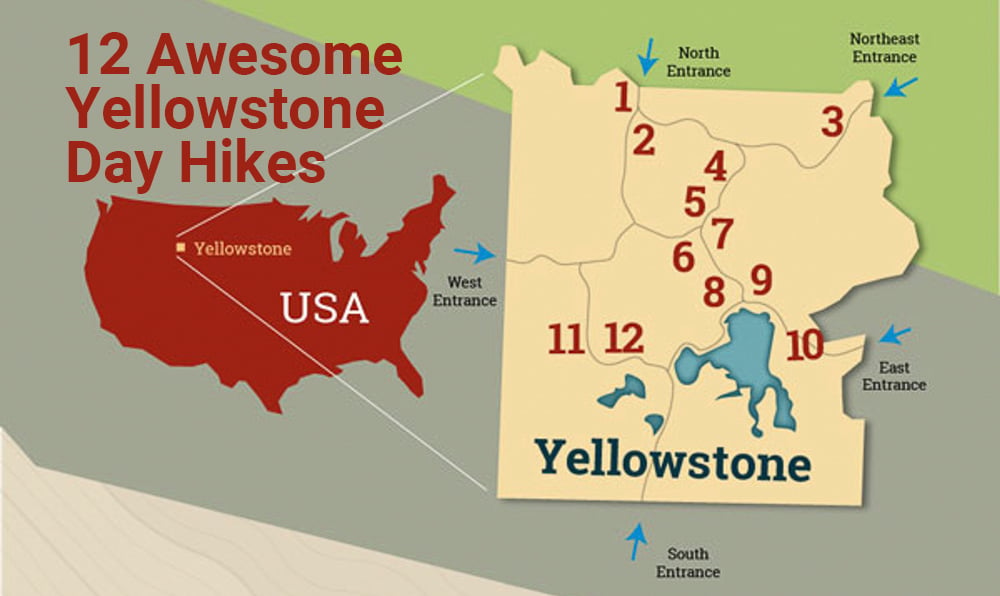
The vast expanse of Yellowstone National Park remains hidden from the roadside, as a staggering 98% of its splendor lies beyond the well-trodden paths. Encompassing over 2.2 million acres and boasting an extensive network of more than 900 miles of remote hiking trails within its pristine wilderness, Yellowstone beckons day-trippers to embark on awe-inspiring journeys to cascading waterfalls, bubbling geyser basins, dramatic canyons, and other natural wonders. If you can’t discover a trail worth your while here, you’ll be hard-pressed to find one elsewhere.
For the most up-to-date trail information and potential closures, make a pit stop at a ranger station or the visitor center. Inquire about the current status of trails, bear activity, weather conditions, and potential fires in the vicinity. No permits are necessary for day hikes in Yellowstone, but consider perusing the Backcountry Situation report for added insights.
Navigating the plethora of Yellowstone’s hiking trails can be a daunting task. To ease your decision-making, we’ve singled out 12 of the most exceptional hikes within Yellowstone, each possessing its own unique charm and challenges.
1. Beaver Ponds Loop
Difficulty: Moderate
Trailhead: North of Liberty Cap, near the stone house or behind Mammoth Hot Springs Hotel at start of Old Gardiner Road
Where to Stay: Mammoth Hot Springs Hotel
The 5-mile trail through forest and sage meadows begins steep, but mellows out with views of Gardner Canyon and leads to the ponds, which features a beaver dam and lodge. It’s generally not crowded and offers a good chance to see wildlife.
The Reward: Feeling like you’re alone in the backcountry wilderness on just a short hike.
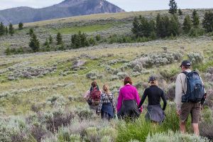
Hikers on the Beaver Ponds Trail
2. Bunsen Peak Trail
Difficulty: Strenuous
Trailhead: 5 miles (8 km) south of Mammoth on the Grand Loop Road. Park in the gravel lot just south of Golden Gate, across from the Glen Creek trailhead.
Where to Stay: Mammoth Hot Springs Hotel
This four-mile hike is short, but requires some work nearing the summit to climb a series of steep switchbacks. The vistas of the Gallatin Mountain Range are the best in the park. You’ll pass a stand of dead trees with an otherworldly feel and a rock formation called Cathedral Rock. There are plenty of photo opportunities.
The Reward: If you’re lucky you may reach the telecommunications equipment on top and find you have the summit all to yourself.
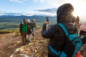
Family photos at the top of Bunsen Peak
3. Trout Lake
Difficulty: Easy
Trailhead: The trail starts from a small pullout about 1.5 miles (2.4 km) south of Pebble Creek Campground on the Northeast Entrance Road.
Where to Stay: Roosevelt Lodge Cabins
The Trout Lake hike is a pleasant 1.2-mile walk in the woods where you might see otters feeding on cutthroat trout in the river or bears foraging. Ospreys dart from the sky to fish as well. The trail rises 150 feet through a Douglas fir forest to a picturesque mountain lake.
The Reward: A chance for some stellar wildlife viewing. Bring your binoculars.
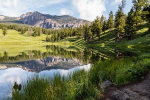
View of Trout Lake from the trail
4. Tower Fall Overlook
Difficulty: Easy to Moderate
Trailhead: Tower Fall Overlook Parking Area
Where to Stay: Roosevelt Lodge Cabins, Canyon Lodge & Cabins, Canyon Campground
The 132-foot waterfall on Tower Creek is stunning, crashing onto the rocks below. This very short hike features minarets sculpted by water through the basalt formation. This hike is easily accessed by people in wheelchairs and starts with an approximately 150-yard asphalt trail leading to a view of Tower Fall. Grades range between 2% and 4%. The lower part of the trail is closed because of severe erosion. You can walk past the Tower Fall Overlook for 0.75 miles, ending with a view of Tower Creek flowing into the Yellowstone River. If you have heart, lung, or knee problems, you may want to enjoy the view from the overlook.
The Reward: A stellar photo opportunity for very little effort.
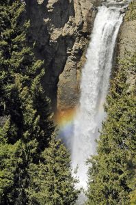
Tower Falls with rainbow
5. Mount Washburn Trail
Difficulty: Strenuous
Trailhead from Chittendon Road: Trail starts at parking area on Chittenden Road, 10.3 miles (16.5 km) north of Canyon.
Trailhead from Dunraven Pass: Trail starts at the parking lot at Dunraven Pass, 4.5 miles (7.2 km) north of Canyon Junction.
Where to Stay: Canyon Lodge & Cabins, Canyon Campground
The 5-6-mile trail switches back and forth through a forested area with mountain top views of the Grand Tetons, and iconic in-park features like Old Faithful Geyser Basin and the Grand Canyon of the Yellowstone. During July, wildflowers blanket the mountain. You’re likely to see bighorn sheep. Nearing the summit, the temperature drops and there are often afternoon storms. Start early if you want to avoid them.
The Reward: It will seem like you’re on the top of the world. You can sit inside the lookout on top and take panoramic shots in comfort at 10,243 feet.
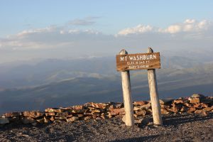
The summit of Mt. Washburn
6. North and South Rim Trails
Difficulty: Moderate
Trailhead: The North and South Rim Drives are accessed from the Grand Loop Road. You can access the trails from various spots along the drive.
Where to Stay: Canyon Lodge & Cabins, Canyon Campground
The Grand Canyon of the Yellowstone is 20 miles long and from 800 to 1,200 feet deep, with the famous Yellowstone River at the very bottom. The North and South Rim drives connect you to several miles of hiking trails and viewpoints. Both sides of the canyon are accessible by car and/or on foot. The North Rim Trail is 3.8 miles across the northwest wall of the canyon, where you can stop and marvel at the Upper Falls and Inspiration Point viewpoints. The South Rim trail is almost 2 miles and ends at the Artist’s Point viewpoint.
The Reward: A chance to experience river views and the stunning rhyolite rock formations of the canyon, guaranteed to fill the memory card on your camera.
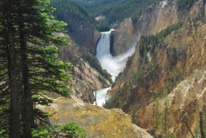
Lower Falls of the Grand Canyon of the Yellowstone
7. Artist’s Point Viewpoint
Difficulty: Easy
Trailhead: At the end of the South Rim Drive.
Where to Stay: Canyon Lodge & Cabins, Canyon Campground
Artist’s Point is easily the most famous and popular viewpoint at the Grand Canyon of the Yellowstone. This viewpoint was believed to be the location where artist Thomas Moran sketched the canyon in 1883. Artist’s Point is one of several accessible overlooks in the park with easy access from the parking lot. Learn more about accessibility in Yellowstone National Park here with specific accessibility information on the canyon village area here.
The Reward: A photo worthy of putting on your wall.
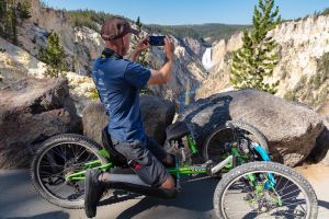
Photographing Lower Falls from an off-road wheelchair at Artist Point
8. Elephant Back Mountain Trail
Difficulty: Moderate
Trailheads: Pullout 1 mile (1.5 km) south of Fishing Bridge Junction.
Where to Stay: Fishing Bridge RV Park, Lake Yellowstone Hotel, Lake Lodge Cabins, Bridge Bay Campground
Make time for this short 3.5-mile hike with stunning views across Yellowstone Lake and the peaks that border its eastern edge. The hike gains 800 feet to the summit, but the trail is well maintained, and it doesn’t feel that steep. The forest is open, making the viewing even easier. Try late afternoon or early evening for the best light.
The Reward: Climbing a mountain without breaking too much of a sweat for an incredible vista.
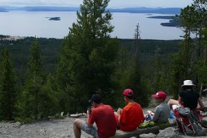
View from the top of Elephant Back Trail
9. Storm Point Loop Trail
Difficulty: Easy
Trailheads: Indian Pond pullout, 3 miles (5 km) east of Fishing Bridge Visitor Center.
Where to Stay: Fishing Bridge RV Park, Lake Yellowstone Hotel, Lake Lodge Cabins,
This is a flat, fun 2.3-mile loop through a forest leading to a rocky peninsula jutting into Lake Yellowstone. You get the trifecta of forest, beach, and water all in one trip.
The Reward: A great place to escape the crowds and enjoy the beauty of a wilderness sunrise or sunset with panoramic views of Yellowstone Lake.

View of Lake Yellowstone from Storm Point Trail
10. Avalanche Peak
Difficulty: Strenuous
Trailheads: Look for a pullout at Eleanor Lake, 19 miles (30.6 km) east of Fishing Bridge Junction (8 miles / 12.9 km west of East Entrance). The trailhead is across the road from the pullout.
Where to Stay: Fishing Bridge RV Park, Lake Yellowstone Hotel, Lake Lodge Cabins,
For many Yellowstone veterans, this is their favorite hike. It begins through forests of meadows with wildflowers, passes gurgling streams, may feature patches of snow even in summer, and concludes 2,100 feet higher on a barren peak with views that stretch across Lake Yellowstone, the Tetons, and the Absaroka Range. When the trail offers options, stick to the left so you can traverse the length of the ridge with the best views.
The Reward: Isn’t the climb enough? OK, take a look at that view. Rock shelters on top make for a great place to share a sandwich.
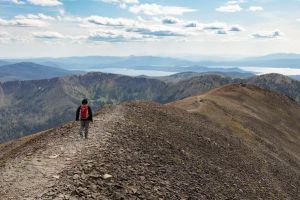
Hiker headed down from the top of the Avalanche Peak Trail
11. Mystic Falls
Difficulty: Easy
Trailheads: Walk 0.3 miles to the far side of the Biscuit Basin boardwalk to the trailhead or begin 0.25 miles (0.4 km) south of Biscuit Basin by parking in pullouts on either side of the road and walking 0.5 miles north along the Upper Geyser Basin–Biscuit Basin Trail to the trailhead.
Where to Stay: Old Faithful Inn, Old Faithful Lodge Cabins, Old Faithful Snow Lodge & Cabins
Head on a 2.0-mile trek through new growth forest then climb to the falls, where the river drops 70 feet as it rushes through a narrow slot. Often, geothermal activity creates an eerie steam. For more out of your trek, continue climbing past the falls to the junction with Fairy Creek Trail and head to the Biscuit Basin overlook.
The Reward: Great views and one of Yellowstone’s classic waterfalls.
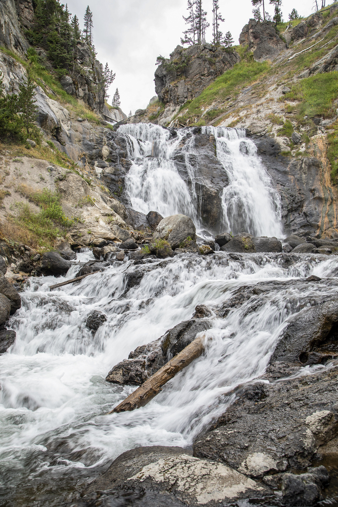
Mystic Falls from the trial
12. Lone Star Geyser
Difficulty: Easy
Trailheads: 3.5 miles (5.6 km) south of Old Faithful Overpass, just beyond Kepler Cascades Parking Lot.
Where to Stay: Old Faithful Inn, Old Faithful Lodge Cabins, Old Faithful Snow Lodge & Cabins
This five-mile round trip starts with a cascade of falls and follows a river, first on one side and then the other, through a wooded valley to reach the centerpiece of Yellowstone’s four backcountry geyser basins. The Lone Star Geyser erupts 30-45 feet about every three hours. There are several log benches in the area where hikers can sit and wait for the geyser. Or perhaps try putting your feet to the pedal as this is one of a few trials in the park that allows bicycles, During the summer, bikes can be rented from the Bear Den Gift Shop at Old Faithful Snow Lodge.
The Reward: The best geyser and river hike (or bike) combination in the park.
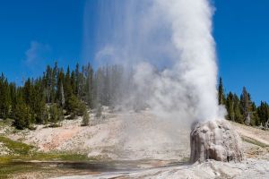
Lone Star Geyser on a sunny afternoon
Bonus Tip:
Want to hit the trails with an experienced guide? Join one of our lodging and learning programs in partnership with the Yellowstone Forever Institute on our Trails through Yellowstone program! This four night package includes lodging, in-park transportation, some meals, and expert hiking knowledge provided by a Yellowstone Forever Field Educator.
Contributors to this article include Jim Morrison
20160705
For A World of Unforgettable Experiences® available from Xanterra Travel Collection® and our sister companies, visit xanterra.com.
Want to experience Yellowstone in-depth? See what makes Yellowstone National Park a great place to work for a season or longer!